Mike Poland's Top 10 Sites in Hawaii Every Earth Scientist Should See
I know I’ll take some flak from my Hawaii-based colleagues (especially those based on Oʻahu) about this list, but here goes…
If I were you, and you were a geoscientist planning to visit the Hawaiian Islands, I wouldn’t miss spending time at the following locales (in order of oldest to youngest):
- Waimea Canyon
The “Grand Canyon of the Pacific” is the must-see geological destination on Kauaʻi. The canyon, which is hundreds of meters deep in places, was formed by erosion due to runoff from Waiʻaleʻale—the island’s highest point and one of the wettest places on Earth (in other words, bring your raincoat). At the head of the canyon, you can look down on the famous Nāpali coastline, on Kauaʻi’s rugged northwest shore. You can also take a muddy, foggy hike to a high-altitude bog, where you can see Hawaiʻi’s only native carnivorous plant, a sundew called the mikinalo (fair warning—it’s small).
 (photo credit: Mike Poland)
- Lēʻahi
On Oʻahu, be sure to hike Hawaiʻi’s most iconic landmark—Lēʻahi (commonly known as Diamond Head, named by British sailors who were not geologists and did not know how to distinguish calcite from dimaond). The few-hundred-thousand-year-old tuff cone is a type example of the rejuvenation stage of Hawaiian volcanism, which can occur millions of years after the host volcano has moved away from the hot spot and become inactive. While hiking on Lēʻahi, you can also explore WWII-era coastal fortifications.
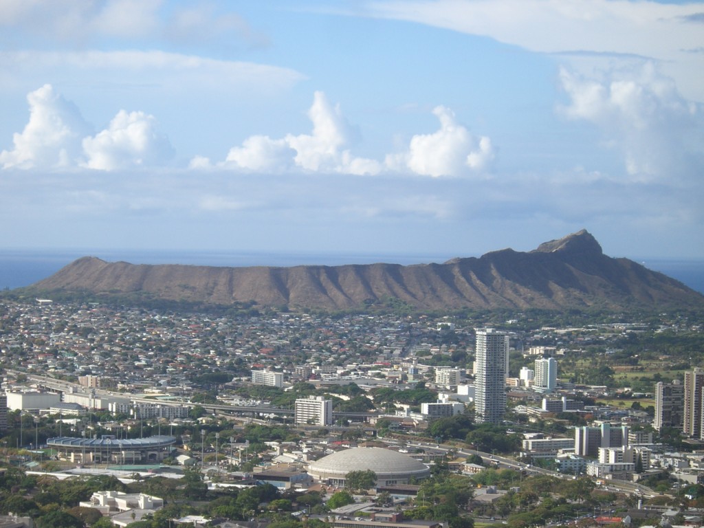 (photo credit: Wikipedia)
- Kalaupapa
Another example of rejuvenated volcanism can be found on Molokaʻi’s Kalaupapa peninsula. The hike (or mule ride, if you so choose; hikers, beware of mule poop) to the peninsula along the island’s north shore provides exceptional views of the sea cliffs (the tallest in the world at over 900 m) that mark the headwall of a giant landslide. The peninsula itself is a National Park that preserves the site’s history as an isolated colony where Hawaiians afflicted with Hansen’s disease were quarantined from 1866-1969. Some patients still remain, making the peninsula their home.
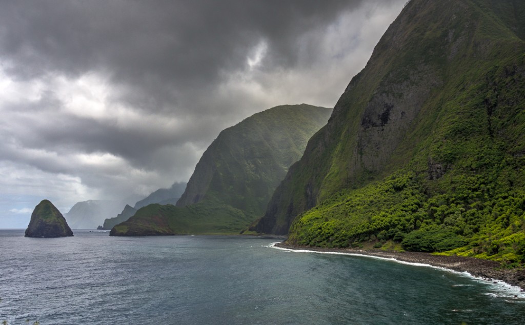 (photo credit: Kyle Anderson)
- On Maui
A popular tourist activity is to watch the sunrise from the summit of Haleakalā volcano, and then coast down the mountain on a bicycle (no pedaling required!). But stay a while, and enjoy the geology of a volcano that is currently in the postshield stage of its evolution and that last erupted about 350–550 years ago. Erosion has carved a large valley (“Haleakalā Crater,” but here again geologists must not have been in on the naming process) into the center of the volcano, in which several cinder cones subsequently formed. While exploring the valley, keep your eyes open for the Haleakalā Silversword—a rare succulent plant that grows at high altitude in the cinder.
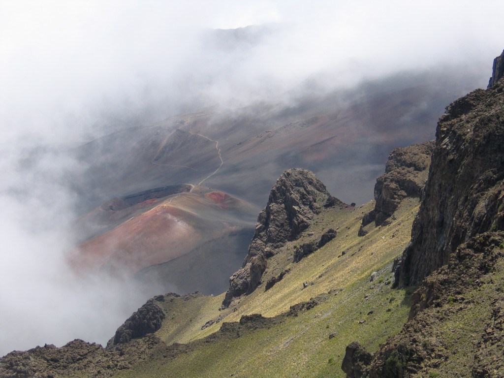 (photo credit: Mike Poland)
- Molokini (reef in action)
Ever wonder where all the limestone you might have walked across on the mainland comes from? See it in its original form at Molokini, a small satellite cone of Haleakalā located off the south coast of Maui. While there are reefs around all Hawaiian islands, this one is particularly impressive, and it occupies the inner part of the cone. The reef can be explored via SCUBA diving or snorkeling, and the abundant fish and coral are spectacular.
 (photo credit: Kyle Anderson)
- Mauna Kea
Another postshield-stage volcano is Mauna Kea, on the Island of Hawaii. Although it is the tallest point in Hawaiʻi, the volcano itself is relatively small in volume, having been built upon the previously existing Kohala shield volcano. The lack of extensive recent volcanic activity means that evidence of glaciers is preserved near the volcano’s summit. It is these glaciers, combined with higher-silica postshield lava flows, that combined to form rock perfectly suited for shaping into adzes (stone carving tools); the adz quarry near Mauna Kea’s summit is the largest primitive quarry in the world. Also arrayed around the summit are about a dozen telescopes some of which offer tours, and nearby is Hawaiʻi’s only alpine lake (Lake Waiau, although some might argue that “lake” is an overly generous name). While exploring, keep your eyes peeled for cumulate xenoliths.
 (photo credit: Mike Poland)
- Hāmākua coast
The Hāmākua Coast forms the northeast shoreline of Mauna Kea and hosts numerous waterfalls and valleys. The coast is also home to the village of Laupāhoehoe, where a tsunami in 1946 inundated a school and killed several students and teachers (160 people were killed across the island in total, most in Hilo). Numerous sugar plantations covered the region starting in the late 1800s, but the last closed in 1993; many of the old warehouses and other buildings remain. At the north end of the coast is Waipio Valley, cut into the flank of Kohala volcano. The deep eroded valley and its spectacular waterfalls can be explored in many ways, including 4×4 (both digital vehicles and analog horses).
 (photo credit: NASA)
- Mauna Loa
The massive Mauna Loa volcano makes up more than 50% of the area of the Island of Hawaiʻi. Most visitors to the island rarely explore its upper reaches, but the summit caldera can be reached as part of a day hike from the Mauna Loa Observatory (the oldest continuous CO2 monitoring station on the planet and the source of data for the Keeling Curve) on the volcano’s north flank. The summit is spectacular, and the hike takes you through a variety of recent volcanic deposits. Be prepared for a wicked headache, however, as the trip involves starting at sea level, driving to the Observatory at 3400 m elevation, and hiking to the summit at over 4100 m.
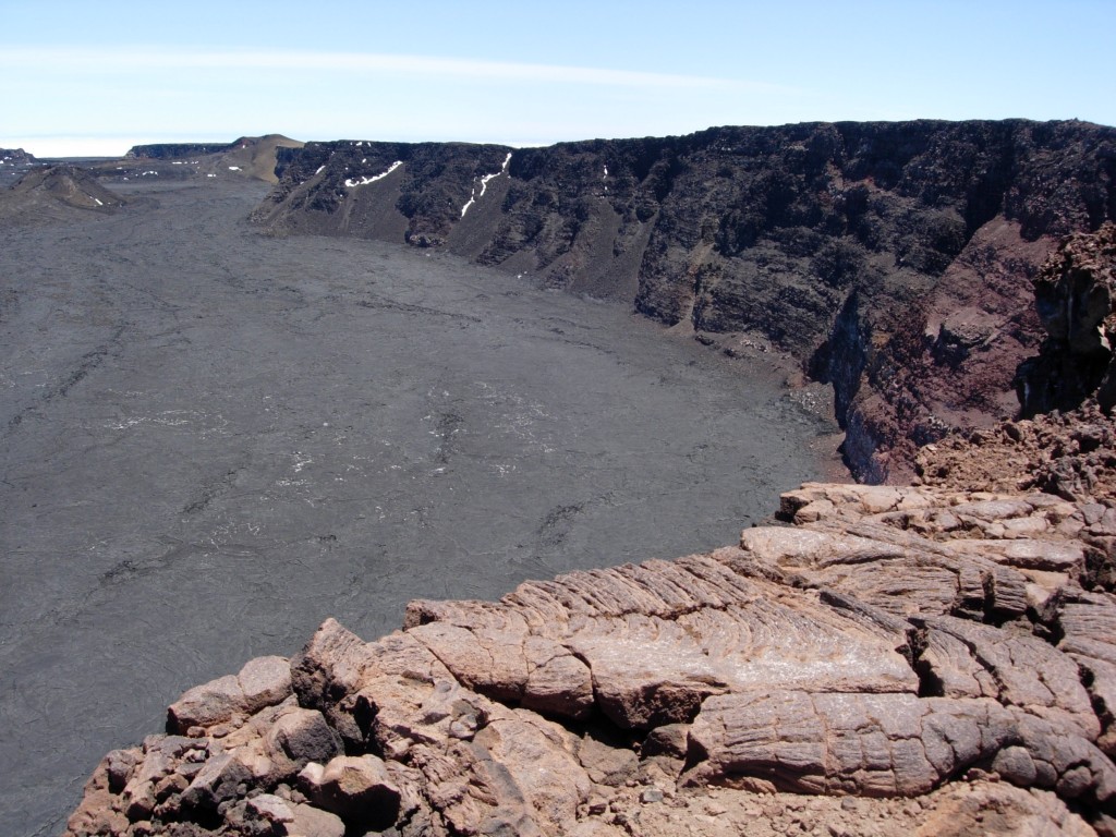 (photo credit: Mike Poland)
- Kīlauea summit
Every geologists should see Kīlauea—the most active volcano on the planet. While most visitors spend only a few hours exploring the main unit of Hawaii Volcanoes National Park at Kīlauea’s summit, it really takes several days to explore the diversity and history of volcanism in the area. Don’t miss spending the evening at the Jaggar Museum (named for MIT professor and founder of the Hawaiian Volcano Observatory Thomas A. Jaggar, Jr.), where the glow from the summit lava lake is best viewed. While exploring, look for evidence that Kīlauea has not always been the gentle volcano we know today. The volcano actually experiences alternating cycles of explosive and effusive activity, each of which can last hundreds of years. Explosive deposits that extend many km from the summit caldera preserve evidence for the latest explosive cycle, which ended in the early 1800s. Contemplate that while standing on the caldera’s rim!
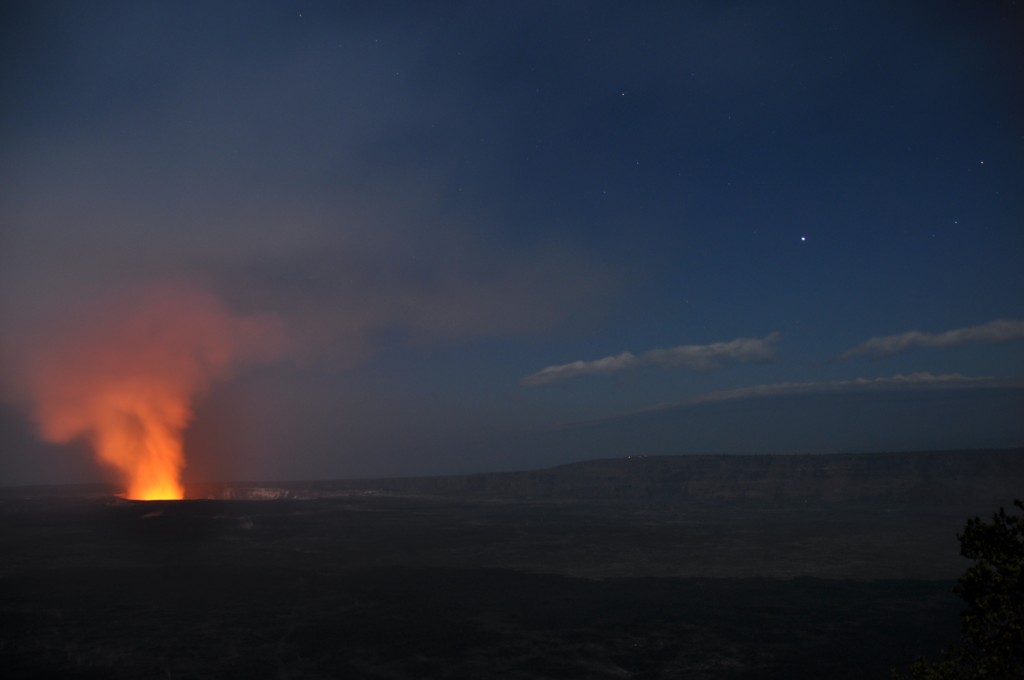 (photo credit: Mike Poland)
- Puna
The Puna District, which makes up the east tip of the Island of Hawaiʻi, is home to extensive rainforests and recent lava flows. It is a place where the effects of volcanic eruptions on society can be readily examined, for instance, in the village of Kalapana, which was overrun by lava in the late 1980s and early 1990s. The district is also a place to explore numerous volcanic features, including recent lava flows (both ʻaʻā and pāhoehoe), the island’s newest black sand beach, and even tree casts. Be respectful of the people and land, though, since the region is currently threatened with inundation by lava from Kīlauea’s Puʻu ʻŌʻō eruption, which has been ongoing since 1983.
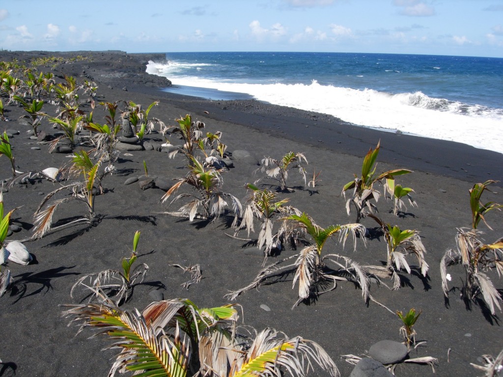 (photo credit: Mike Poland)